
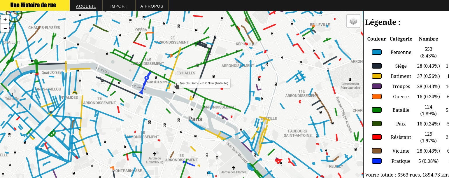
Streets Highlight, "Une histoire de Rue"
Histoire de Rue presents a cartographic view of the history of Paris, in collaboration with the YouTuber/Historian Sur le champ.
It is an innovative web platform that enables users to explore streets imported from a CSV file.
 This open-source project aims to provide an accessible and interactive way to visualize urban data.
Data Source
The data showcased on the homepage is sourced from OpenData Paris, meticulously labeled by “Sur le Champs”. This ensures that users are viewing accurate and well-organized information. The labeled streets offer a comprehensive insight into the street histories and specifics, making it a valuable resource for urban explorers and data enthusiasts alike.
Import Your Map
One of the standout features of Histoire de Rue is the ability to import your own map. Users can simply upload a CSV file to view their data in a dynamic map format.
This feature broadens the application’s usability, allowing for customized data visualization based on individual needs or research requirements.
Technical Stack
The website is built using straightforward tech stack to ensure both functionality and ease of use:
- HTML/CSS/Vanilla JS: These core technologies form the backbone of the web interface, providing a smooth and interactive user experience.
- Leaflet: This powerful library is used for map navigation, enabling users to seamlessly explore and interact with the maps.
- Jawg Maps: As the provider of customizable dynamic map backgrounds, Jawg Maps integrates Open Street Map data to offer a detailed and versatile mapping experience.